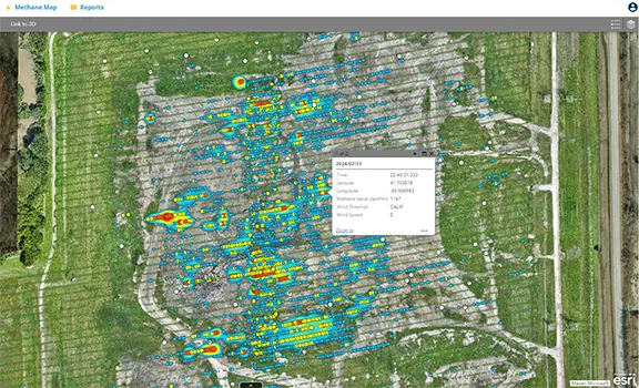
Methane (CH4) and Hydrogen Sulfide (H2S) Monitoring
Experience safer, truly remote emissions monitoring with our advanced drone-based methane detection system. Equipped with a gimbaled TDLAS sensor, tuned specifically for methane, with a measurement range of 1-50,000 ppm-m, a 30-meter detection distance, and the ability to take readings every second, the system self-calibrates for precise, real-time data. Operating autonomously at a 20-meter flight height with terrain-following capabilities, it ensures smooth data collection without disrupting site operations. The drone’s 360-degree obstacle avoidance enhances safety in complex environments. Each exceedance is geotagged and captured with imagery for clear visual reference. We provide comprehensive, actionable data visualization tools to analyze trends, track site progress, and monitor overall health. Additionally, we offer H2S sampling using tube-based detection, providing a complete, non-intrusive solution for gas monitoring and safety.
Benefits:
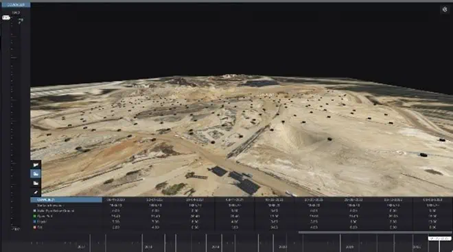
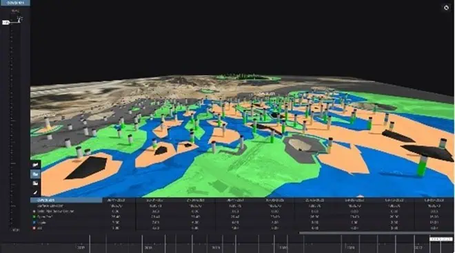
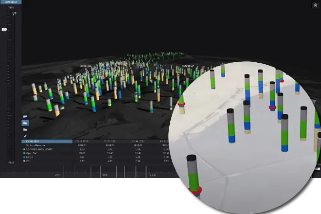
3D Liquid Well Data Visualization
SCS RMC offers a powerful 3D liquid well data visualization tool, providing a dynamic way to assess well field and overall site conditions. This tool allows you to visualize liquid well data in detailed 3D cross sections of the site, displaying key information such as elevation, the amount of solid pipe below ground, open perforated pipe, liquid levels, and silt accumulation for every well across a landfill. This system integrated with drone surveys, offers a comprehensive view of site conditions from above and below ground.
With 3D Liquid Well Data, you can incorporate and store large amounts of historical data in one centralized location, with the flexibility to continuously add new data. This enables you to analyze trends over time, ensuring better decision-making and site management.
Terrestrial – Aerial LiDAR Scans
SCS RMC uses a combination of aerial and terrestrial LiDAR imagery to produce extremely detailed point clouds. These LiDAR scans use a combination of Simultaneous Localization and Mapping (SLAM) scanners as well as traditional terrestrial scanners.
The point clouds are produced with a combination of aerial and terrestrial LiDAR scans are useful to create Building Information Modeling (BIM) to represent the physical and functional characteristics of buildings and other assets.
Benefits:
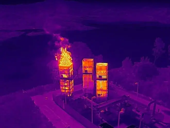
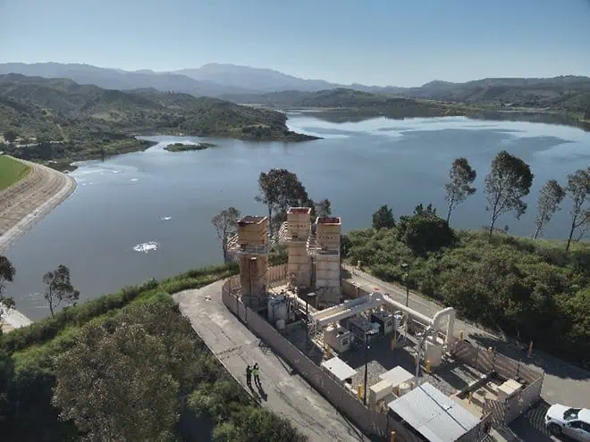
Thermal and Structural Integrity Inspections
SCS RMC uses a drone equipped with thermal imagery and a 360-degree camera to inspect the structural integrity of landfill flare systems visually. The drone can conduct visual inspections of both the interior and exterior of a flare structure and can capture both thermal and RGB imagery.
Benefits:


Topographic Mapping/Ortho
SCS RMC uses drone technology to produce surface maps of project areas. The imagery collected by the drone produces a detailed image of the entire site conditions on a certain day. The image can be useful to incorporate with other inspection data and track/compare progress of a specific project.
With imagery from the drone and the use of Ground Control Points (GCPs), SCS can accurately map the surface of a project area. This data enables evaluating and measuring conditions such as airspace limits of waste, cut/fill maps, and stockpile monitoring.
![]() Benefits:
Benefits:
Share this page using icons or email, or our brochure.
The video below shows the most valuable sensors and technology in use at a landfill. A much faster, safer, and efficient way to collect data!