Join SCS on June 10 for another client webinar. Using case studies, we show you how our clients tackle common challenges using proven GIS technology to reduce expenses and run more productively.
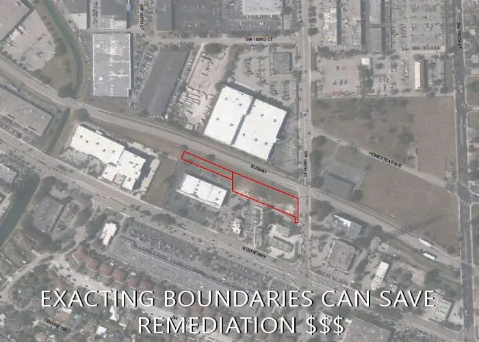
Property Development: Time is money on development projects. Environmental engineers use GIS to more accurately pinpoint potential contamination sources, conduct site assessments, strategize remediation solutions, and see sampling results weeks faster. Infographics and dashboards show if and exactly where to continue sampling without waiting weeks or months for reports.
Landfills: Operators make diagnostic and forensic use of GIS to address maintenance tasks faster. We’ll cover modeling 3D wells and liquid level data, showing how GIS embedded dashboards and infographics pinpoint exactly where to assign staff. At the same time, supervisors monitor completed assignments seeing real-time results and what still needs attention.
Siting Solid Waste Facilities: Decision-makers use multi-criteria decision analysis incorporated into a geographic information system to account for relevant technical data, environmental, social, and economic factors during the site selection of a waste transfer station. The resulting maps and infographics are useful at public meetings too.
Corporate Headquarters