SCSeTools® – Developed by Landfill Gas Practitioners for Landfill Owners and Operators
The Birth of LFG Data Tracking
In the early 2000s tracking landfill gas data at facilities was anything but uniform, organized, or secure. The industry was using various methods to track data on paper forms and logbooks, then transferring it by hand into spreadsheets. Some of us used desktop database applications, but as the saying goes, necessity is the mother of invention.
From an SCS employee’s idea for demonstrating how to use landfill gas monitoring data to analyze and pinpoint system corrections, SCS DataServices® was born. In the span of several months, a team of SCS’s landfill engineers, field technicians, and technology gurus worked with client-needs to create a concept application visualizing collected landfill data on maps. Our staff field-tested it with good results, and SCS Field Services began using the application to visualize issues with wellfields that aren’t readily apparent when looking at spreadsheets.
A large SCS landfill client had seen our field staff using DataServices, asked if SCS would consider providing them with access to the application on a subscription basis. Our team adapted DataServices, added features, and continued improvements tailored for the client’s use.
As soon as secure data transfer became feasible, SCS moved to an Internet-based solution for our landfill gas practitioners. The platform called SCSeTools® holds the data collected by SCS DataServices®.
Applications and features roll out as we continually update and upgrade, incorporating ideas and improvements from our users and staff along the way. DataServices is addressing the landfill gas management needs of over 600 landfills across the US and Canada in 2021.
The keys to success follow our mission and values of maintaining close communications with our clients, field staff, engineers, and eTools support staff (all landfill gas practitioners), with the help of software engineers. Technology companies are not up at night thinking about landfill operations, but we are.
We introduce our SCS eTools landfill technology capabilities and a few of the creative and talented SCSers behind the technology in the next segment. Our speakers walk you through demonstrations of how over one-third of the landfill owners and operators in North America are increasing efficiencies using SCS eTools.
Visualizing Landfill Challenges – Shortcuts to Keeping Your Wellfield in Balance
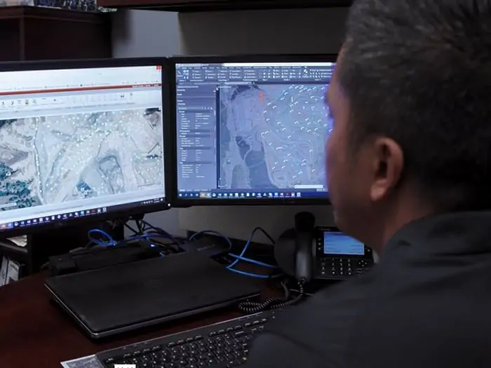
DataServices shows the entire wellfield for any monitored parameters and zooms in on troublesome areas or wells. Results can be as simple or detailed as the landfill owners’ environmental and business needs dictate. The detailed examples here illustrate how graphs, maps, and charts help keep the wellfield in balance. We link each challenge to the description of a video demonstration.
In balance means extracting more gas for renewable energy, preventing odors and methane migration, keeps subsurface and surface conditions and workers safe. The information can help diagnose equipment conditions before they become costly, maintain regulatory compliance, and support cost estimates if the landfill is expanding or more infrastructure investment or equipment is needed.
Looking at vacuum distribution across a gas collection system – Select the system pressure map, which highlights vacuum distribution across the wellfield to show the wells with good (expected) vacuum, pressure drop over distance, and any wells unexpectantly losing vacuum. Zooming in and changing the vacuum ranges further enhances where to assign staff to troubleshoot any identified issues.
Using a methane distribution map shows whether the wells are tuned to where the landfill owner wants them. Wells may be identified below the targeted range, indicating slight over pulling; a technician can use this map to identify such issues and quickly check the identified wells. Wells identified above the desired methane tuning range indicate wells not collecting enough gas, which has consequences. These wells can be the source of odors, leachate seeps, possible lateral migration to an out of waste probe. Not sending enough fuel to a power plant or atmospheric releases can affect surface emissions monitoring.
Managing liquids – Changing waste streams and more rainfall in certain areas of the country complicates liquids management. DataServices visualizes the impacts of liquids on wells and helps landfill owners better manage a proper liquids removal program. The program will let them know how many pumps to budget for and, over time, where to relocate well dewatering pumps so that they are most efficient at removing liquids from landfills.
High-BTU Gas Plants –Filter maps help users locate wells contributing to gas dilution into renewable energy plants. It can help create punch lists for landfill staff to investigate, troubleshoot and tune. As wellfield technicians make corrections, they show on the map in real-time.
Temperature and subsurface oxidation events – Some call the condition subsurface fires, but this is a serious issue for landfills. Over-pulling wells, damaged infrastructure, and other conditions can cause oxidation events. Using a combination of temperature Parameter Maps to review wellhead temperature distribution and a Points Chart feature provides a deeper dive into the data. It provides more insight into which well or wells may be contributing to the high-temperature issues.
Locating a specific well – That’s not so easy when hundreds of wells surround you and at larger landfills. DataServices had built-in filter features to identify a single monitoring point on a wellfield map easily.
Customizing for compliance, best practices, and rules – DataServices allows monitoring points across a single site to have customized rules for each monitoring point. Rules can be for regulatory purposes, standard operating procedures, best management practices, and even site-specific preferences or any combination thereof. It is efficient to customize rule application to landfills and collection points – meaning wells, probes or ports, horizontal collectors. This customization capability helps organize and confirm regulatory compliance. It is especially salient with the 2021 EPA and state compliance changes for a single landfill or an organization with hundreds of landfills.
MobileForms – Inspection forms, blower flare station monitoring forms, load tracking from municipalities, incoming hazardous waste tracking, MRF bale counts are examples of paperless entry available. The data feeds directly from mobile phones to the supervisor and into the maintenance department, so staff can start cataloging and looking at what’s going on in real-time at several types of facilities. It’s available for regulators and inspections and helps reduce staff hours tabulating and centralizing the information. Any information historically captured on a form or log attached to a clipboard can now be captured and stored electronically. From there, it can be recovered and produced as a PDF export file or data from the forms used to trend data and help make informed operational decisions.
MobileTools – DataServices in a condensed format suitable for mobile devices. Field staff use MobileTools to save time formerly used to return to the office, transfer/transcribe the collected data and upload it to a supervisor for quality checks before storage. Technicians can now recall the last 20 readings for any given well and review trend graphs on their phones or tablets while standing adjacent to the well they have questions about and need to access the data. MobileTools also allows them to upload field data such as liquid level readings while the data is being collected. The information instantly populates into DataServices and is available for review by others on the project team.
The most valuable tools are in development now for release in 2022. ARC GIS integration developed under SCS RMC® will further enhance DataServices with even better visualization and location capabilities and provide enhanced features such as allowing landfill owners to see their well as-built information and view subsurface information about their wells.
Learn more at SCS Engineers, where we adopt our clients’ environmental challenges as our own.
Corporate Headquarters