Route Optimization for Waste Collection Finds Surprising Benefits for Even Small Municipalities
Running optimized collection routes is critical for a waste company’s or municipality’s bottom line; it’s also a dauntingly complex job. This is where experts skilled in waste collections route optimization come in. There could be thousands or more ways to get from one service point to the next along a single route; now think about an intricate web of routes traversed by a whole fleet. Then throw in other possible variables, like different route densities, overlapping vs. non-overlapping routes, and holiday and inclement weather schedules. And if you are like one fast-growing Midwestern city, you have plenty more to take on as you work to stay on top of that growth and changes that come with it.
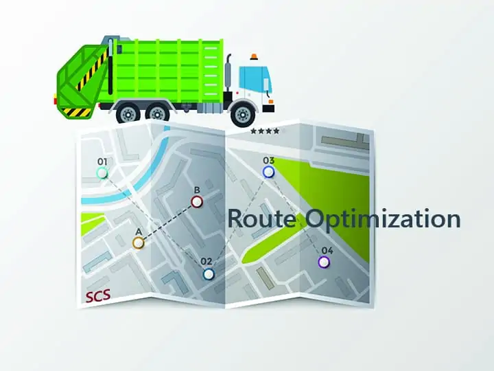
Geographical Information Systems (GIS) help achieve collection route optimization.
One way this Midwest municipality stood up to the challenges is with GIS, which stores, processes, analyzes, and maps spatial data. SCS Engineers’ Emily Smith helped the city leverage the technology to identify and make needed changes, better serve customers, and ultimately save money and time.
“When we came in to help, they had multiple small routes scattered across their service area, which was a problem that became more difficult as the city was growing. Haulers were putting in a lot of overtime to meet deliverables while complying with regulations restricting driving hours. They needed to take more breaks between driving time to stay within those limits, which stretched out their days further,” Smith says.
“Then there’s the wear and tear on tires and the trucks themselves and fuel cost, among issues.”
Working with route optimization consultant Kevin Callen, she used GIS to help restructure and better balance routes.
An ecologist, Smith started using the technology years ago to map out wetlands and for groundwater monitoring. That gave her the knowledge base to figure out how to develop maps to optimize collection routes; these powerful systems are flexible, with broad capabilities and applications.
“I like identifying where there is room for improvement and making visual representations of projects so clients can see the scenario as more than numbers on a page. It tells a story and makes it easier to grasp when they have a visual, color-coded representation,” Smith says.
GIS is useful to map out garbage carts and recycling carts down to an individual customer or street and the number of houses in a neighborhood. It can identify one-way streets or low bridges that larger trucks may need to bypass, among relevant information to plan the most efficient paths. We layer these details and other customizable data to get a comprehensive picture to help design the plan.
Smith began by teasing out information that the city already had. Using surveys created with targeted questions, she could obtain information about specific route challenges (tight alleyways, street parking, confusing setout locations, etc.). The information helped inform potential route modifications.
The outcomes for the Midwest municipality:
Existing waste routes can be modeled in GIS and revised that show impact before and after revisions under consideration. This capability extends beyond fine-tuning residential collection routes. For instance, GIS can do geoprocessing of data to calculate where to put a recycle drop-off center or transfer station that will service a given number of customers.
Additional supports weaved into GIS.
Besides saving labor, travel time, and fuel and vehicle maintenance expenses, routing has more qualitative aspects of gaining efficiencies.
“By talking to collectors with boots on the ground, we find ways to enhance driver safety by identifying problem areas like locations prone to flooding and those with low-hanging tree branches or power lines. Leveraging GIS can also help reduce truck impacts to roads and neighborhoods and reduce emissions. And it can help address customer service issues — for instance, by mapping and taking notes on special backdoor service customers with limited mobility, collectors know to pick up their bins closer to their homes,” says Ryan Duckett, an SCS engineer who leverages GIS to support clients on the East Coast.
For one Texas city, it was a way to systematically and quickly clean up volumes of existing data that had inaccuracies. This was key to later being able to perform an analysis providing intel for route load balancing.
“There were approximately 200 points that needed to be updated to reflect their actual locations. We provided a method to verify and change the information via an online interactive GIS mapping application. They can edit each field, inputting appropriate route information,” says SCS’s Brooke Aumann, who has 14 years working with GIS. The municipality used this same system to review the new routes and provide comments, allowing its staff to be an active collaborative partner in optimizing each route, Aumann says.
Curbside waste collection is hard work. It involves a lot of physical labor, operating heavy equipment, adhering to tight schedules, and sometimes pivoting fast.
“Having this powerful tool that enables us to streamline the process and make collections easier and more efficient is a big plus, especially as we continue to expand and improve other waste and recycling services that depend on, or impact, collections. GIS is a unique opportunity to apply computer technology to come up with practical approaches to real-life problems and realize substantial savings in time and money,” Duckett says.
Corporate Headquarters