SCSeTools® – Developed by Landfill Gas Practitioners for Landfill Owners and Operators
The Birth of LFG Data Tracking
In the early 2000s tracking landfill gas data at facilities was anything but uniform, organized, or secure. The industry was using various methods to track data on paper forms and logbooks, then transferring it by hand into spreadsheets. Some of us used desktop database applications, but as the saying goes, necessity is the mother of invention.
From an SCS employee’s idea for demonstrating how to use landfill gas monitoring data to analyze and pinpoint system corrections, SCS DataServices® was born. In the span of several months, a team of SCS’s landfill engineers, field technicians, and technology gurus worked with client-needs to create a concept application visualizing collected landfill data on maps. Our staff field-tested it with good results, and SCS Field Services began using the application to visualize issues with wellfields that aren’t readily apparent when looking at spreadsheets.
A large SCS landfill client had seen our field staff using DataServices, asked if SCS would consider providing them with access to the application on a subscription basis. Our team adapted DataServices, added features, and continued improvements tailored for the client’s use.
As soon as secure data transfer became feasible, SCS moved to an Internet-based solution for our landfill gas practitioners. The platform called SCSeTools® holds the data collected by SCS DataServices®.
Applications and features roll out as we continually update and upgrade, incorporating ideas and improvements from our users and staff along the way. DataServices is addressing the landfill gas management needs of over 600 landfills across the US and Canada in 2021.
The keys to success follow our mission and values of maintaining close communications with our clients, field staff, engineers, and eTools support staff (all landfill gas practitioners), with the help of software engineers. Technology companies are not up at night thinking about landfill operations, but we are.
We introduce our SCS eTools landfill technology capabilities and a few of the creative and talented SCSers behind the technology in the next segment. Our speakers walk you through demonstrations of how over one-third of the landfill owners and operators in North America are increasing efficiencies using SCS eTools.
Visualizing Landfill Challenges – Shortcuts to Keeping Your Wellfield in Balance
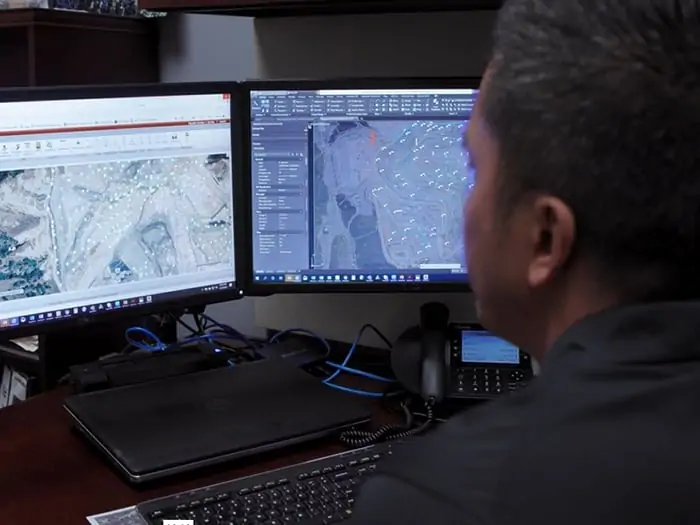
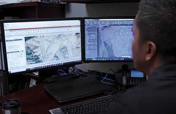
DataServices shows the entire wellfield for any monitored parameters and zooms in on troublesome areas or wells. Results can be as simple or detailed as the landfill owners’ environmental and business needs dictate. The detailed examples here illustrate how graphs, maps, and charts help keep the wellfield in balance. We link each challenge to the description of a video demonstration.
In balance means extracting more gas for renewable energy, preventing odors and methane migration, keeps subsurface and surface conditions and workers safe. The information can help diagnose equipment conditions before they become costly, maintain regulatory compliance, and support cost estimates if the landfill is expanding or more infrastructure investment or equipment is needed.
Looking at vacuum distribution across a gas collection system – Select the system pressure map, which highlights vacuum distribution across the wellfield to show the wells with good (expected) vacuum, pressure drop over distance, and any wells unexpectantly losing vacuum. Zooming in and changing the vacuum ranges further enhances where to assign staff to troubleshoot any identified issues.
Using a methane distribution map shows whether the wells are tuned to where the landfill owner wants them. Wells may be identified below the targeted range, indicating slight over pulling; a technician can use this map to identify such issues and quickly check the identified wells. Wells identified above the desired methane tuning range indicate wells not collecting enough gas, which has consequences. These wells can be the source of odors, leachate seeps, possible lateral migration to an out of waste probe. Not sending enough fuel to a power plant or atmospheric releases can affect surface emissions monitoring.
Managing liquids – Changing waste streams and more rainfall in certain areas of the country complicates liquids management. DataServices visualizes the impacts of liquids on wells and helps landfill owners better manage a proper liquids removal program. The program will let them know how many pumps to budget for and, over time, where to relocate well dewatering pumps so that they are most efficient at removing liquids from landfills.
High-BTU Gas Plants –Filter maps help users locate wells contributing to gas dilution into renewable energy plants. It can help create punch lists for landfill staff to investigate, troubleshoot and tune. As wellfield technicians make corrections, they show on the map in real-time.
Temperature and subsurface oxidation events – Some call the condition subsurface fires, but this is a serious issue for landfills. Over-pulling wells, damaged infrastructure, and other conditions can cause oxidation events. Using a combination of temperature Parameter Maps to review wellhead temperature distribution and a Points Chart feature provides a deeper dive into the data. It provides more insight into which well or wells may be contributing to the high-temperature issues.
Locating a specific well – That’s not so easy when hundreds of wells surround you and at larger landfills. DataServices had built-in filter features to identify a single monitoring point on a wellfield map easily.
Customizing for compliance, best practices, and rules – DataServices allows monitoring points across a single site to have customized rules for each monitoring point. Rules can be for regulatory purposes, standard operating procedures, best management practices, and even site-specific preferences or any combination thereof. It is efficient to customize rule application to landfills and collection points – meaning wells, probes or ports, horizontal collectors. This customization capability helps organize and confirm regulatory compliance. It is especially salient with the 2021 EPA and state compliance changes for a single landfill or an organization with hundreds of landfills.
MobileForms – Inspection forms, blower flare station monitoring forms, load tracking from municipalities, incoming hazardous waste tracking, MRF bale counts are examples of paperless entry available. The data feeds directly from mobile phones to the supervisor and into the maintenance department, so staff can start cataloging and looking at what’s going on in real-time at several types of facilities. It’s available for regulators and inspections and helps reduce staff hours tabulating and centralizing the information. Any information historically captured on a form or log attached to a clipboard can now be captured and stored electronically. From there, it can be recovered and produced as a PDF export file or data from the forms used to trend data and help make informed operational decisions.
MobileTools – DataServices in a condensed format suitable for mobile devices. Field staff use MobileTools to save time formerly used to return to the office, transfer/transcribe the collected data and upload it to a supervisor for quality checks before storage. Technicians can now recall the last 20 readings for any given well and review trend graphs on their phones or tablets while standing adjacent to the well they have questions about and need to access the data. MobileTools also allows them to upload field data such as liquid level readings while the data is being collected. The information instantly populates into DataServices and is available for review by others on the project team.
The most valuable tools are in development now for release in 2022. ARC GIS integration developed under SCS RMC® will further enhance DataServices with even better visualization and location capabilities and provide enhanced features such as allowing landfill owners to see their well as-built information and view subsurface information about their wells.
Learn more at SCS Engineers, where we adopt our clients’ environmental challenges as our own.

When Doug Doerr got a call from a Colorado-based landfill operator with a hot gas probe at his site’s boundary, Doerr’s day kicked into high gear. Chasing down gas migration problems is nothing new in an SCS client manager’s life, but that reality makes the job no less complex. And in this scenario, he was dealing with a site that he occasionally got called to visit, so to understand the problem fast, he needed the site’s historical data and the current information to fully picture what was happening.
Doerr started with basic landfill gas information from the client: the monitoring probe’s location and a drawing of the gas collection system to determine where the probe was in relation to the gas system. But as you know, that is one small slice of a king-sized pie.
 “All the LFG data that I would typically wade through to identify the problem can be overwhelming, but I had a recourse enabling me to get up to speed quickly. It didn’t take long to assess the problem,” he says. That recourse is a combination of quick teamwork from his peers nationwide and sophisticated technology developed by SCS practitioners for landfill owners and operators.
“I queried our in-house landfill gas technical group (engineers, geotechnical experts, and field personnel). And got over 25 responses within several hours with suggestions, one of which came from Ken Brynda in SCS Field Services, who leveraged DataServices to help me identify and narrow down the potential cause of the problem,” recalls Doerr.
DataServices, a module of the SCS eTools® digital platform, collects, stores, manages and analyzes large volumes of continuously accumulating landfill gas data for individual sites or multiple landfills. The module provides a quick method to view landfill gas scenarios.
The beauty of it is that it generates maps and charts to visualize every well and every probe. These system components are viewed in relation to one another and in relation to the perimeter, where the methane on that Colorado site flowed. Further, SCS Field Services’ landfill gas gurus, such as Ken Brynda, plug-in specific parameters that keep a close watch on any well or a group of wells.
 “I logged into DataServices and pulled data from the five wells closest to the hot probe, which showed we had vacuum, flow, and gas quality, indicating the wells were pulling hard enough. I shared the results with our landfill gas technical group responders in a table and range map I’d created. And they started chiming in,” Brynda recalls.
As responders viewed initial results from their respective bases around the country, Brynda churned out more information in a few hours, running point charts to capture the balance gas, methane, flow, temperature, supply vacuum, and the vacuum applied to each well. He looked for trends that narrow down cause and point to solutions.
Eliminating the Possibilities – Rule Out Well System Malfunctions
“It can take days if we’d had to do it the old school way with spreadsheets laid out in a lot of rows. But we could identify the potential problem in a matter of hours, backed by a comprehensive evaluation for the landfill operator in eight hours,” Doerr says.
When Field Services staff work to solve a problem with a probe, they look for an outlier, something from a group of wells that’s not behaving like the other wells. In this case, Brynda determined that the wells near the hot probe were functioning properly. DataServices eliminated potential problems by slicing through and analyzing large chunks of data confirming the system was working efficiently.
Next, we observed that the wells are likely too far away to pull gas back from waste, adjacent to the probe in question, where there are no wells.
“DataServices helped rule out malfunctions, and that’s a big deal because if you can confirm the landfill system is working properly, you have narrowed your focus and can look toward other possibilities, ultimately leading to corrective options,” Doerr says. Brynda and Doerr suggested putting in temporary wells in that area to avoid odor migration and health and safety issues.
Doerr continues watching the situation and is prepared with a several-point action plan to mitigate exceedances and avoid falling out of compliance. “We continue watching the data to ensure the gas collection system continues to function well. Should there be issues again, we’re able to fully identify the gas migration pathways and anything in the system that looks out of the ordinary,” Doerr says.
If the client decides to add wells in time, data from the expanded infrastructure will be added to the app and monitored. “As the number of wells grows, DataServices grows with it, adding any, and as much, monitoring and collection data as the operator wants. DataServices will always be in the background to monitor, collect and analyze LFG data in real-time, whenever we need it,” he says. Being able to store, organize, dissect and analyze unlimited volumes of information from one location is powerful. And not just because it helps operators identify problems as they are happening, but because it and our teams can support them in looking for trends over time. Keeping an eye on the activities that keep the systems in balance is less costly.
For Doerr, who spends time in the field but longer hours with his clients, DataServices and the ability to interact quickly with experts like Brynda help SCS deliver more value to clients. “As much as I’d love to master DataServices, I need to focus all of my time on my clients’ business and goals; having support from Field Services and DataServices makes us all more efficient.”
Landfill Technologies and Comprehensive Expertise
SCS eTools® and SCS DataServices®, now with SCS MobileTools® for viewing data and charts anywhere; available to pull landfill data into DataServices for analyzing. You can customize and focus on exactly what you need fast. As Doug and Ken emphasize, it’s info that you likely already have, but may not be able to use quickly for troubleshooting.
SCS RMC®, remote monitoring and control of landfill equipment and systems.
Comprehensive Landfill Services
Our industry is in a period of a rapid transition to digital data management, but particularly on landfills. Often you read that the latest technology, whether by a brilliant programmer or rolling out as part of a takeover, is innovative. Linking technology and innovation is becoming commonplace, but they are not the same. Innovation is a human process requiring experimentation and iteration to solve landfill issues that often have nothing to do with computers or mobile phones. Landfill technology or apps are tools.
Innovation takes a team of diverse expertise, different perspectives with a constant desire to learn, and most importantly, the primary desire to make landfill operations more efficient and safe. Innovators use technology when and how it makes sense to improve environmental management, profitability, and care for employees and the local community. Lower cost solutions for the vast amount of data collection completed faster and without human error come from people with hands-on in-the-field experience. When it comes to landfill technology, its value is clear when a landfill practitioner demonstrates how the particular technology fits into a solution. The nice part is they also get to the point and skip the tech-speak and jargon.
The Landfill Technology Evolution Started Here in 2003
Back in 2003, SCS couldn’t find technology that would enable our engineers and technicians to support landfill operations as we desired. Proving the proverb “necessity is the mother of invention,” we developed a database for our use. Its value in the field was immediate, and SCS continued to adapt and develop SCS DataServices® and SCS MobileTools®, basing refinements on each landfill and client need. It took people in the waste industry to make the right technology tools for the industry.

Meet Oliver Early, SCS’s DataServices and MobileTools Product Manager. Oliver started his career managing landfill operations. He became interested in technology because it got results for him as a landfill manager of 15 facilities. By combining a comprehensive investigation of physical landfill systems, such as landfill gas collection and control and other environmental monitoring and control systems with evaluations of compliance areas, he improved his landfill system performance and substantially increased power plant production. He used multivariate data techniques, including time series and network analysis, to scrutinize and refine results. Merging DataServices capabilities under Oliver’s guidance took SCS’s original internal database to a timesaving product for all landfills, not just the landfills SCS operates.
The platform, called SCS eTools®, includes modules for leachate, groundwater, DataServices, and the newest application SCS MobileTools, free for those using DataServices. The technology is currently in use on over 630 landfills nationwide and benefits all of SCS’s design, build, and operations work.
For example, if methane readings at a gas probe are elevated, that’s an indication of a potential LFG migration issue. While expertise is great – it could take hours to diagnose and mitigate. With DataServices, you could run an evaluation of the existing well field in a few minutes, ruling out issues with current wells. With the touch of a button, you can share the information with your team and focus on potential mitigation recommendations.
Remote Monitoring and Control Technology Didn’t Happen Overnight Either
The best and most innovative solutions come from combining the stakeholders’ experiences and thoughts. Let’s meet a few of the people who lead other landfill innovations.

In addition to being a licensed drone pilot herself, flying over 100 landfills, Business Manager Melissa Russo uses SCS Remote Monitoring and Control (RMC) technology to support her landfill clients. Her contributions increase safety and lower environmental risk using unmanned aerial vehicles to gather field data at a lower cost. Melissa developed SCS’s national drone and geographic information systems (GIS) programs to respond to her clients’ needs for expensive regulatory and operating challenges. As a result, capturing more (methane) greenhouse gas instead of releasing it into the atmosphere provides the obvious environmental benefits, and landfill personnel have better and safer working conditions.
Depending on the sensor or camera attached, her pilots can monitor methane concentrations using a tunable diode laser, measure and map surface temperatures to mitigate elevated temperature conditions, or create topography, aerial imagery, and estimate filling volumes. Operators can view, detect and measure changes over time, gaining insight into critical infrastructures such as water infiltration, liquid flow, and vegetation distributions. Melissa’s use of GIS provides a low-cost solution to data management and sharing between field and office.
Melissa is an innovator who genuinely cares about our industry, taking the time to listen and truly understand her clients’ challenges and long-term goals. Only then does she devise customized solutions, regardless of whether it uses technology or not. See Melissa at work.
The Internet of Things (IoT) is Bang for Your Buck

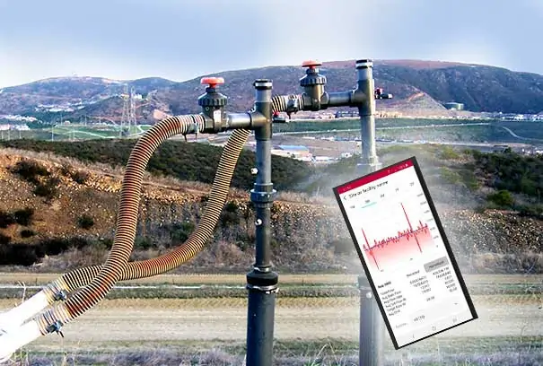
SCS RMC’s Business Manager is David Hostetter. His experience includes remote monitoring and controls systems engineering, construction, and operation; landfill gas and leachate engineering; and mechanical engineering. Dave’s focus is on automating remote process control of landfill systems, landfill gas blower/flare stations, wellfield vacuum and flow, along with leachate and groundwater pumping systems, weather equipment, and air monitors.
As a landfill gas engineer, his impetus was to avoid production downtime and keep operations within regulatory mandates. He wanted his clients to see what was happening at any given time and be alerted to atypical conditions. As a landfill engineer, he knows that “prevention is better than cure,” as long as it’s cost-effective. Dave’s solution is to leverage the Internet of Things through SCS RMC systems. Each piece of equipment you want to monitor gets a sensor. His team configures each sensor or group of sensors to parameters based on his operator’s business needs and environmental reporting responsibilities. A local wireless network communicates with a base station providing continuous readings from each sensor.
RMC sends alerts if readings are outside an acceptable range or if an environmental threshold is nearing exceedance. Alerts go to the landfill’s designated staff or technicians via smartphones, computers, or tablets. From these devices, users access their interface to control, start, stop, and reset field systems and analyze system operation. They can also view data, graphs, tables, alarms, and reports.
That’s more than convenience; it saves labor dollars spent to diagnose and reset these systems and is especially valuable for remote landfills. By design, clients can enable custom authorization levels for their systems. Naturally, the analytical tools are easy to use, understand, and report, as he explains in his video.
Albert Einstein Said…
“You can’t solve a problem on the same level that it was created. You have to rise above it to the next level.” We’re not comparing ourselves to Einstein, but all three SCSers leading their teams know that compliance policy never stops changing, and landfills are unique beasts made up of complex systems that need balance to perform. Performance is based on daily decisions and landfill readings generating enormous amounts of data. SCS’s job is to make your job better by collecting those millions of data bits for analysis faster, helping landfill operators use the intelligence to identify the cause and appropriate response to hundreds of issues that are part of landfill or facility management.
The backbone of every service at SCS Engineers is to design and develop based on our clients’ specific needs. As innovators, our mission is to leverage proven technology to meet those needs. As our founders did, we strive to understand our clients’ current and future needs, then develop or integrate the appropriate technology to meet those needs.
SCS is one of the most experienced and successful environmental compliance, design-build, operations, and maintenance firms in the United States. No stand-alone technology company can substitute for our knowledge and hands-on experience with innovative landfill design, build, and operations.
Visit SCS Engineers to discover SCS eTools and SCS RMC capabilities. You’ll find case studies, technology awards, and more resources for using technology to manage labor, liquids, air monitoring, groundwater, volume, GHGs, and more
A two-part interview with Landfill & LFG Engineer Sol Sim, Product and SCS Field Services Manager Oliver Early, and Software Developer Brooks Ballentine.
As technology advances to optimize landfill operations and ensure compliance, so does the amount and type of data available to support operators in making informed decisions.
The industry is adding more and more data points to fill in the story of a landfill’s health, driving this demand for ‘big data,’ delivered in real-time. Sprouting alongside this big data trend is another one: employers rely less on laptops and more on mobile devices, and they expect those devices to have sophisticated functionality.
In response, SCS Engineers launched SCS MobileTools®. This powerful app is the latest addition to SCSeTools®, a platform created to standardize data acquisition, optimize data use, and ensure that data is secure.
Watching in Real-Time
MobileTools enables field workers to pull up data on their iOS or Android mobile devices and observe real-time activity through a secure, wireless connection. It means they no longer have to connect instruments to their laptops and forward files to another source for upload to the eTools platform.
Instead, data goes from users’ smart devices to the cloud, enabling field workers, as well as operators and other decision-makers who work remotely, to access that information immediately.
“MobileTools builds on SCSeTools, which constantly takes in data and validates, analyzes, displays, and reports on that data. We realized that by incorporating technologies we’ve already built into this platform into the mobile devices, existing data acquisition workflows could be enhanced,” says Brooks Ballentine, SCS director of Software Development. “The result reduces effort and costs while increasing accuracy.”
“We’ve added wireless data transfer to MobileTools because the ability to access information within 24 hours is not good enough. We want to be within minutes to catch exceedances immediately,” says SCS engineer Sol Sim, who manages clients’ landfill gas operations.
“This is a real-time upload. So, if technicians are out in the field collecting data and a well has an exceedance, they can send a notice. If corrective action is required, the tech is already there to take that action,” he says.
Keeping Tabs on Flares
MobileTools is equally instrumental in keeping close tabs on flare activity, capturing information to identify overall flow trends, and ensuring the system meets stringent compliance requirements.
“Each flare has a data logger that records regulated parameters, such as gas flow and temperature. Data is stored minute-by-minute on the logger and typically requires an extensive manual process or expensive and complicated networked solutions to aggregate data in a centralized data repository. With MobileTools, this same data is transmitted in a simple process using existing mobile devices,” says Oliver Early, the product manager of SCSeTools-DataServices.
Early’s story around SCSeTools began in 2008. At the time, he was a client of SCS, paying to use the app to support a landfill gas-to-energy developer in ensuring regulatory compliance.
“I joined SCS in 2013 to come up with more features and push the app forward with new ideas and new ways of doing things, with wireless data transmission being the most recent advance,” he says.
Users of MobileTools can interact with site-specific data such as exceedance metrics for landfill gas, liquid levels, and surface emissions. And they access touch-enabled data charting to review daily gas loads recorded by flares.
MobileTools has the ability to attach photos to provide supporting visuals for more information and or to put data in context. This facilitates communication between field technicians, site managers, and corporate management, who can get a more tangible “picture” of what’s going on in the field.
As with every feature in the eTools suite, MobileTools is designed with data integrity and security in mind.
In the case of landfill operations monitoring data currently collected by hand, MobileTools will digitize the process, allowing for faster acquisition and near real-time analysis.
Integrating More and Different Data – Validation
“We are integrating data in MobileTools that is not currently collected on standardized instruments, such as liquid levels and pump cycle counts.
“So, with monitoring data that was recorded on paper, then entered into spreadsheets, techs now type it directly into the device. It is validated and then uploaded,” Ballentine says.
These and other features and functions are designed to be time and money savers. Field workers who now have a streamlined protocol can accomplish more in a day, freeing themselves for maintenance projects and other tasks. Operators can rely less on consultants to review data and identify potential issues or needed improvements.
Sim is part of the team involved in further developing and testing SCSeTools. That landfill practitioners developed the platform for landfill practitioners is key to its effectiveness, he surmises.
“We are not a software company dabbling in landfills; we are landfill operators. We know the industry, as well as the functionality needed in landfill software.
“Field engineers, staff, and technicians have been asking for a mobile app for some time. The ability to have data at our fingertips in the field is a tremendous tool for quickly troubleshooting issues,” Sim says.
Part I of the Interview Series
A two-part interview with Landfill & LFG Engineer Sol Sim, Product and SCS Field Services Manager Oliver Early, and Software Developer Brooks Ballentine.
Back in the day, environmental engineers and landfill operators had to create their own spreadsheets to track mountains of data, then try and figure out what all that data meant, a tedious process with limited functionality. But that’s changing, and SCSeTools® is at the forefront of the evolution. This powerful yet user-friendly digital platform automates data management; harnesses an ever-growing volume, type, and complexity of information; and expands on what solid waste professionals can do with that information.
Created by landfill practitioners, for landfill practitioners, SCSeTools collects, monitors, analyzes, and manages data on key landfill operations and assists in reporting. It’s leveraged by SCS staff and its clients nationwide to help facilitate sound operational and engineering decisions while saving time, labor, and money. Because operators get information in near-real time, they can act quickly and proactively should red flags spring up in their tightly regulated world.
The platform includes three modules: SCS DataServices®; SCS Groundwater™; and the newest feature—SCS MobileTools®. Collectively these customizable toolsets have the flexibility to capture the big picture of a site’s overall health or zero in on what’s happening at a single gas wellhead, leachate collection sump, or other location. The modules’ design supports the smallest and largest sites and serves operators managing one, 10, or even hundreds of facilities.
From the Big Picture to the Fine Details
SCS DataServices is the flagship product and the one that SCS engineer Sol Sim uses most. This module captures and utilizes landfill gas facility monitoring and management data. It’s also designed to serve as a compliance reporting tool.
Sim likes to tap into the app to look through different lenses, depending on what he needs to see and understand.
“You can use SCS DataServices to get a broad overview of what is happening, but you can also drill down to see where you need to focus to ensure you are spending time and resources efficiently,” he says.
Being able to dissect large volumes of data quickly, then key into the finer details as needed has made his job easier. And he can work smarter and faster.
“Without this tool, it’s a bit of a needle in a haystack. But now, we can easily visualize and pick out relevant, near real-time data to assess performance. And when there are deficiencies, we can make adjustments promptly—maybe upgrade a wellhead or upgrade laterals to optimize gas production,” he says.
Connecting the Dots in a Visual Format
The GIS mapping function, a component of DataServices, has been one of Sim’s go-to tools. It provides data points for individual locations within a landfill system and helps connect the dots in a visual format.
“You have point references and can spatially display a lot of data at once so, unlike with a spreadsheet format, you can see and process where a well is in relation to others,” he says.
Custom mapping captures any parameter, whether data points around gas flow, header vacuum or gas quality. Ranges are set to identify trends and, ultimately, provide information to make more informed decisions.
This ability to spot trends or patterns is integrated into features beyond mapping. A built-in algorithm helps determine if a client’s operations are trending in the right direction, and that determination can be made as patterns unfold, which helps field staff stay on top of the curve.
“If changes occur slowly, it typically takes time to notice, but if you look at six months or more of data at a time, you see that 1 percent change in temperature or flow, for example, that has crept up incrementally. You have one visual snapshot that captures a lot of data fast. So, if there are issues, you can get to the route quickly and make adjustments practically in real-time,” Sim says.
The DataServices module has served well as a troubleshooting tool. Sim illustrates with a real-life scenario: a client whose landfill gas-to-energy project was grossly underperforming.
“They had data but no way to review it efficiently to try and understand what was happening. They were ready to bring in a new operator. We were able to come in; upload their data into our system; identify the problem; and make easy, relatively inexpensive upgrades that increased their gas extraction by close to 15 percent.”
Besides helping to realize direct dollar benefits, the tool can compute and outline deficiencies from a regulatory standpoint.
“Our client had outstanding past exceedances that had not been remedied properly. We helped them get back into compliance and mitigate potential future issues that could have resulted in fines,” Sim says.
When SCSeTools was created, the primary goals were to standardize data acquisition and ensure that the data was secure. It was used internally at first, at a few landfills. Clients began asking for it, and now the toolsets are leveraged at over 650 locations across the country, both by SCS and clients who operate their sites.
Ensuring Data Integrity – Simplifying Processes
It continues to evolve, with one of the early advances being encryption of data collected in the field, which means that it can’t be modified when transmitted to the app.
Before, there could be errors if a file was interrupted or data mishandled as it moved along the chain of custody, explains Oliver Early, the product manager of SCSeTools.
“And now we have taken the capabilities even further,” says Brooks Ballentine, SCS director of Software Development.
“Today, we are enhancing MobileTools so field technicians can enter and transmit data directly from their mobile device to SCSeTools. This not only ensures data integrity but simplifies the process,” he says.
Data integrity and ease were the front and center focuses while designing each feature and function. Another example of this is that the software enables gas measuring instruments to be configured to align with well configurations.
“Every gas well has a unique configuration, and they are often reconfigured. Because we can synchronize the configurations from eTools to each technician’s instrument, we end up with more accurate, consistent readings, when, before, that was impossible,” Early says.
Staying On Top of Timelines
Operators must stay on their game to keep up with regulated monitoring timelines, whether involving activity at wells, monitoring probes, or flares. Some sites have hundreds or even thousands of data points with individual data timelines and, what’s more, those timelines can change. DataServices, in particular, works to simplify the detail-heavy process. It supports operators in better managing prescribed monitoring events in a couple of ways: by enabling them to view data for a specific monitoring period and by allowing them to set events to align with mandated periods.
So, if systems were out of compliance and now have to be monitored more often, the frequency can be set accordingly.
In addition to DataServices, with its robust capabilities around managing landfill gas systems data, the SCSeTools suite features one more module.
SCS Groundwater tracks constituents to help manage water quality and to mitigate or remediate issues. It was developed to enhance operational efficiencies while also providing a means to validate that reporting requirements are being met.
Users can set up and track monitoring plans consisting of sampling points and required analyses at each point. They can track the datasets of constituents, as well as constituents within each dataset that they are required to monitor. These constituents can be tracked over time to determine if seepages are controlled and follow progress if adjustments are required.
Once the data is uploaded into SCS Groundwater, the app checks it against the monitoring plan to verify that all work is complete. “This is a key feature because the number of possible methods, and associated analytes, is large, and ensuring that the required testing project has been completed correctly is critical,” Ballentine says.
“We are not done”: Expanding Capabilities
SCSeTools, with its three modules and mobile app, has advanced over time to keep pace with operators’ needs in an ever-changing, complex industry, and Sim says, “We are not done. We continue to leverage new technologies and to add features and functions so that we can make the best, most cost-effective decisions possible on behalf of our clients.”

SCS Engineers’ SCSeTools® platform and applications help facilities and companies operate more efficiently by continually gauging operational health and identify trends critical to operations and the environment.
SCS Technology Services®, the technology development practice within SCS Engineers, announces a new application for tracking and analyzing environmental data. The application expands the firm’s SCSeTools® platform, demonstrating its commitment to developing the most advanced data-driven technology in the environmental services industry.
Groundwater monitoring and compliance services are long-term and expensive responsibilities that generate enormous amounts of monitoring and laboratory data. SCS Groundwater™ is a tool to monitor and manage the data associated with operations and reporting requirements for various sites. Sites include active or closed landfills, plants, and impact sites such as former dry cleaners or industrial facilities.
The application also monitors and manages data effectively for clean groundwater applications such as groundwater basin management projects consistent with standard protocol under state and federal environmental compliance rules. SCS Groundwater™ collects and efficiently organizes groundwater monitoring and maintenance data providing those responsible for environmental compliance with a reliable, consistent, and cost-effective way to manage the large volume of information.
The application’s primary value is enabling users to set up a detailed monitoring plan for any number of events, including the sampling points to include and what analyses to perform at each point. Once the information upload is finished, the application checks incoming data against the plan to confirm all work is complete.
SCS Groundwater™ generates reporting components such as data tables, charts, graphs, and maps for compliance, reporting, and finding trends. For example, on a brownfield site, the compliance manager could upload historical monitoring data results, view the data trends over time, and then produce report tables and figures. Operators can also use the data in other applications for additional analysis or visualization.
SCS Engineers’ environmental solutions and technology directly result from our experience and dedication to industries responsible for safeguarding the environment as they deliver services and products. For information about SCS, visit the SCS eTools pages or enjoy our 50th Anniversary video to see the technology in action.
The SCSeTools® platform and applications help facilities operate more efficiently by continually gauging operational health and spot trends that help determine when and how to invest in infrastructure. Field staff, environmental compliance experts, brownfields, developers, and clients in the waste industry guide the technology designs. For additional information and demonstrations of these productivity-enhancing tools, please contact .
Corporate Headquarters